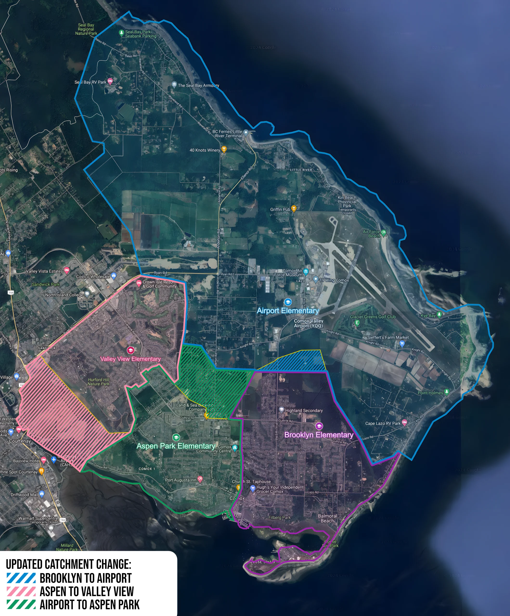
Catchment Map
The Yellow lines denote current catchment boundaries and solid lines denote the adjusted catchments.
Instructions for mobile users:
- Click map to enlarge
- Drag finger to pan
- With two fingers on image:
- Pinch fingers together to zoom in
- Spread fingers apart to zoom out
Instructions for desktop users:
- Hover over the map to enlarge it.
- Use the mouse wheel to zoom
- Hold down the left mouse button and drag to pan the map.
Google Maps Version